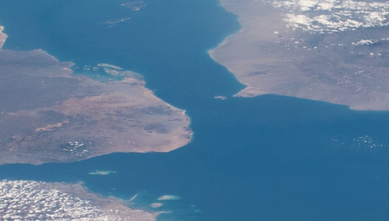
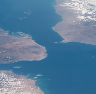
Bab el-Mandab
Ely Tahan
3/22/20252 min read
There exists a stark disparity between the nation-charted terrain of geopolitics and the lived, interwoven land-community of mineral, vegetal, and animal entities—including humans. Geopolitical intrigue, driven by international power struggle, is superimposed onto the planet’s ecological mesh—a web of life that transcends provisional borders. This ecological continuity, untethered to national demarcations, possesses its own organic silk roads, trade routes, and collective migrations. Yet, the geopolitical layer remains impermeable to a planet-first ethos. The nation-state framework, with its rigid boundaries, resists yielding to the bioregional realities of the Earth, even as it is ultimately bound by them.
Despite centuries of exploitation and terraforming by colonial and imperial powers, the physical shape of continents, the merging and partitioning of seas, the porous nature of mountains, and the inescapable forces of climate impose undeniable constraints. National borders, far from being organic expressions of the land, are grafted onto its complex anatomy—a political film laid over the geophysical body. Nevertheless, geography still asserts itself: it draws the trajectories of trade routes, determines their flow, and enforces natural chokepoints that become sites of strategic contestation.
Consider, in this moment of geopolitical upheaval, the significance of Bab al-Mandab—the narrow strait whose name, the "Gate of Tears," evokes its treacherous waters and storied suffering. Though physically modest, this passage exerts an outsized influence on global affairs. Throughout the 19th century, the British East India Company occupied the region, erecting a lighthouse to command the Red Sea and secure access to the Suez Canal—a vital artery of colonial trade. Only in 1967 did the British relinquish their colonial grip, ceding control to the indigenous population. Yet, half a century later, the strait’s strategic importance continues to reverberate.
Today, in response to the ongoing genocide in Gaza, the Ansarallah movement uses this very chokepoint to disrupt maritime access to the Red Sea, thereby blocking Israel’s supply routes. In a bitter twist of irony—or perhaps poetic justice—the same corridor that once facilitated colonial commerce has become a tool of local resistance. Despite the artificial carving of the Middle East by Western powers, Bab al-Mandab now functions as a pressure valve, fiercely directed against the encroachments of US empire, the economic machinery of the European Union, and the rogue apartheid state of Israel. The strait, once a symbol of colonial control, now embodies the defiant assertion of regional agency—an organic reclamation of place against the superimposed grid of geopolitical power.
By Earth Science and Remote Sensing Unit, NASA Johnson Space Center - JSC Gateway to Astronaut Photography of Earth
Explore the artworks
of Ely Tahan on social media:
CONTACT
© 2025. All rights reserved.